Monday, 25 July 2011

Sault Ste. Marie to Ottawa

Distance travelled over last 7 days: 846 km
Total distance: 5392 km

Since Sault Ste. Marie, the topography has changed noticeably. To this point, the rolling hills of Ontario made for a dependable pattern: as I scaled each small hill, I knew I would be going down it in two or three hundred meters. But now, the land is flatter, and farming is more prevalent.

I traveresed Sault Ste. Marie to Blind River with relative ease. With the shores of Lake Superior behind me, I was now travelling along Lake Huron. Locals tell you to expect a change in the weather, but for me, it continued to be hot and humid. This made for some fascinating morning fog on the morning I left Blind River.

Morning fog in Blind River

From Blind River, I put in a long day of cycling to cover nearly 170 km into Sudbury. Peter, who I contacted over couchsurfing, was kind enough to host me for the night and give me a walking tour around the city, which included Science North - a kind of Telus World of Science located in Sudbury. Sudbury also has Canada's second tallest free-standing structure: the 380 m tall stacks from the nickel smelting facilities. The immense height of the stacks is intended to disperse the pollutants into the atmosphere as much as possible.

Science North is shaped like a snowflake from above
The next morning, I finally got my bicycle chain and cassette replaced before I left Sudbury. It was paricularly hot, so I drenched my towel in water and draped it over my head. It wasn't long before I had people approaching me speaking Spanish!

Senor Michael
On a day where the weather was so extreme, I found a lot of people were compassionate to me, the lowly cyclist. At a rest stop en route to North Bay, some RVers connected with me, and stocked me up with ice and chilled water. I stopped in at a number of gas stations just to wet my towel and quench my desire for a cold drink. Beating the heat also meant taking a fully-clothed dip in a lake along the way. According to the forecast, it reached 36 C / 97 F, but according to the waitress at Tek's seafood restaurant in North Bay, it hit 45 C. The restaurant was great: I had all-you-can-eat fish and chips, and placed a few phone calls back home to connect with family and friends. I really enjoyed my stay in North Bay, and found the downtown area to be much like Gastown in its architecture and brickwork.

Monument at North Bay
From North Bay, it was three days of cycling to get to Ottawa. The first day was flat until I left Mattawa at lunch time. After Mattawa, it was a struggle to get to camp. The terrain turned hilly all of a sudden, and everything seemed uphill. Each hillcrest revealed another hill behind it, and the pattern continued for more than 4 hours. I got to camp exhausted; unfortunately it was a provincial park, and like all provincial parks, it was notoriously expensive. It was also full of noisy neighbours and children on bicycles. Until the parks have walk-in or cyclist rates, that will be the last provincial park I stay at if I have any say in the matter!

First look at Ottawa River from the Provincial Park
The second day to Ottawa took me past Deep River (a Manhattan Project community), Petawawa (a Canadian Forces Base) and Pembroke. I had a late lunch and several calorie-rich drinks at Pembroke before heading to Cobden for the night. I was on pace to have some relaxation time at camp, but I caught a flat just 3 km from the first campground. I didn't know precisely how close I was at the time, so I fixed the flat on the spot. It turns out a staple pierced the side-wall of my rear tire. I reached Bona Vista campground at about 8 pm - enough time to tent out and freshen up before sundown. I found it to be a well-serviced campground and a pleasure to stay at.

Finally, I was within a day to Ottawa. It was Sunday morning, and for some reason the Trans-Canada was packed with traffic in both directions. At times along my trip, the noise of the traffic has been overwhelming, and I desire for it to go away so that I could cycle in silence. I think it's busy here for good reason, however. The highway turns into the 417 near Ottawa - a big 6-lane (or more?) highway that cyclists cannot ride on. Instead, I detoured into the city of Arnprior, where I grabbed lunch and zig-zagged my way down quieter secondary roads and cyclepaths into Ottawa, where I met with several brothers and sisters for dinner.

A view of Arnprior, where I got some lunch before reaching Ottawa
Today, I spent a rest day under the kind hospitality of Brother Yinsuo. It was overcast, and cooler than days prior, but made for an enjoyable tour of Parliament Hill (free!), Byward Market, and after crossing the interprovincial bridge into Quebec, the Civilization Museum.

The Parliament Building and Peace Tower, with 53 bells

Arches in the Parliament building
The Rideau Canal
Tomorrow I am taking one more rest day in Ottawa to run errands before I head off towards Montreal.

Monday, 18 July 2011

Thunder Bay to Sault Ste. Marie

Distance travelled over last 8 days: 802.7 km
Total distance: 4546 km

After day upon day of rolling Ontario hills, and the need to run errands around town, I took a half-day off in Thunder Bay. It was here that I got the aforementioned (previous blog entry) camera battery replaced; then I started looking for a barber shop. I went from shop to shop, but for some reason they were all closed on this Monday afternoon. Then, as luck would have it, at one closed shop, the barber arrived coincidentally. He explained that I would not be able to get my haircut, as the barbershop association had legislated closure on Sunday and Monday! Go figure... I left town with a mop still sitting on my head.

A few kilometers out of town is a monument to Terry Fox. It is in Thunder Bay that Terry prematurely ended his Marathon of Hope due to resurgent cancer. This local stretch of Highway 17 is named the Courage Highway in memorial of Terry.

Terry Fox monument outside Thunder Bay
From this same vantage point, one can look across Lake Superior and view the Sleeping Giant jutting out into the water. With a bit of imagination, you can see the giant's head at the left, his arms folded across his chest, and his feet at the right.

The sleeping giant
I didn't plan to travel very far over the course of my half-day out of Thunder Bay. My destination was less than 30 km out of the city, at Thunder Bay International Hostel. I was anticipating an opportunity to meet a very interesting character - more about that in a moment. I thoroughly enjoyed my stay at this hostel. For a very affordable rate, I found the place to be peacefully quiet, secluded and full of charm and character! The elderly owners are very friendly and hospitable.

Which way to Vanoucver, again? (Taken outside the hostel)
Shortly after nine in the evening, the guest of the evening arrived. Meet Jean Beliveau, world traveller and true gentleman. Jean set off to walk around the world eleven years ago from his hometown of Montreal, Quebec. Since then, he has walked through the US & Mexico, South America, Africa, Europe, Asia, Australia & New Zealand, and he is now less than 100 days away from finishing right back where he started! Along with all the supplies he pushes along in a stroller, Jean carries a binder, which includes a map of his travels, and pictures from meetings with figures such as Nelson Mandella and various world presidents and leaders.

A quick footnote in Jean's 11 year journey!
The next day was a quiet ride through Nipigon, to a stealth campsite that offered a great view of Lake Superior. Although the weather was overcast all day, I managed to stay dry the whole time, which on the whole made for pleasant riding conditions.

The next morning, I awoke to a beautiful pastel-red, orange and blue sunrise over Lake Superior. The sound of the bird-calls echoing through the woods was quite spectacular, and continued into my ride. In Ontario, the bird-calls sound like the native Indian songs they surely inspired; much better than the squawking red-winged blackbirds of the prairies.

Morning light shines across the sky above Lake Superior
The terrain through this part of Ontario has reminded me of British Columbia, but miniaturized. On this particular day, instead of spending a whole day tackling a BC mountain pass, I attacked four steep hills, each gaining and then relinquishing roughly 200 m of elevation. The first valley landed me in the Indian Reserve of Pays Plat, which I sped through; the second valley brought me to Rossport, where I took in the beautiful lake and boat launch.

A view of the beautiful lake and dockside at Rossport.
After leaving Rossport, it wasn't far to Rainbow Falls Provincial Park, and I decided I had to stop and take a look - I'm glad I did! A beautiful, pristine lake fed the successive falls, which flowed over pink granite rock.

The peaceful lake that feeds Rainbow Falls
The third valley of the day was in Schreiber, where I visited Aguasabon falls. These falls were easily more spectacular than those at Rainbow Falls, just due to the sheer elevation drop and power of the water. Even from my vantage point way up above the water, I could feel the mist landing on my face and arms.

Overall, it was a very enjoyable day of cycling, with lots of towns and exciting stops along the way. The descents were some of the quickest of my entire journey, reaching speeds of 68 km/h. In the evening I camped at Neys, where I used the wifi to catch up on emails - cellular service in Northern Ontario is atrocious!

Aguasabon Falls roaring in the background
Day 42 of my trip took me from Neys to White River. This town's claim to fame is that it is the birthplace of Winnie the Pooh et al. The visitor center at White River allows free tenting on their lawn, which was conveniently close to a gas station and an A&W.

White River - where it all began!
I was expecting an easy ride out of White River to Wawa, but I was wrong! Strong headwinds made progress slow and frustrating. After a brief snack, I crossed paths with another adventurer, who was riding a 4-wheel bicycle to Vancouver. Well, he had been riding: moments before, one of his axles snapped, forcing him to push his vehicle along the roadside, hoping to meet someone with a welding kit. Unfortunately, I couldn't be of much help to him... I hope he managed ok!

On this day, I passed the marker designating 1000 km of Trans-Canada highway riding since the Manitoba border. A little further, and I reached Wawa, where I was finally able to get the haircut I had so long desired! Wawa gets its name from the native word "wewe" for bird - or geese - or something like that. At any rate, there are several large geese sculptures around town, and many smaller geese statues and ornaments.

Big Geese at Wawa
On the barber's advice, I headed a little south to Michipicoten. I trekked 5 km of tricky terrain to get to Sandy Beach, which was on the shore of Lake Superior, and very secluded. I pitched my tent on the beachfront with the sun still high in the sky, and as I headed for bed, I was serenaded to sleep by the lapping of the waves.

Picture-perfect at Sandy Beach in Michipicoten
I left Sandy Beach the next morning, and entered Lake Superior Provincial Park - the Ontario analogue of Kootenay National Park in the Rocky Mountains. There are numerous beautiful bay views here: Old Woman Bay with 300 ft cliffs and Katherine Cove were a couple of highlights. I made it out of the park in time to reach the more affordable Twilight Campground, saving me from having to shell out for one of the expensive provincial camps. I was treated to a scenic sunset over the lake shortly after 9 pm.

Sunset at Twilight Campground
The weather from Wawa to Sault Ste. Marie was very challenging. Southerly winds brought elevated temperatures and high humidity into the area, which sapped the strength and energy from my legs. The humidity felt jungle-like, and stopping for rests made cycling further feel like a daunting task. I found, however, that the best strategy was to keep on going, as once I was pedalling, the airflow helped to regulate my body temperature and keep a fresh supply of air into my lungs.

As I entered into Sault Ste. Marie, I passed a marker that supposedly commemorates the Trans-Canada Highway at the midway point. The plaque, however, appeared to be missing! (Vandalism?! Maintenance?) After the brief respite and self-congratulation, I hurdled one more big hill into the Soo, where I reached the home of Brian and Margaret. The evening brought heavy thunderstorms and a brief power outage. Needless to say, I was very glad I had a roof over my head and a comfortable bed to sleep in.

The marker with the missing plaque!
Today, I took a rest day in the Soo, where I visited the boardwalk and canal. I had planned to replace the chain and cassette on my bicycle due to all the wear and stretch that has accumulated along the journey, but the local bicycle technicians were occupied for the day, and advised that I could delay the maintenance for a little while longer.

When I depart from the Soo tomorrow, I will be hoping for more tolerable temperatures and humidity!

Monday, 11 July 2011

Winnipeg to Thunder Bay

Distance travelled over last 6 days: 767 km
Total distance: 3743 km

The thought of going into Ontario was foreboding. I knew out would be vast, desolate, and to some degree, treacherous!

I left Winnipeg without much of a plan, letting the wind, the road and the kilometers take me where it wanted. I passed a significant marker that day: the longitudinal midpoint of Canada. At the end of the day, I wound up at Falcon Lake, which has a grocery that yielded the supplies for my 6-egg pepperoni omelette and chili. Falcon Lake is really quite stunning in the evening, and was a great place to camp for the night.

The Longitudinal Center of Canada

The next day, I crossed into Ontario, and I knew it immediately - the cultivated land of Alberta, Saskatchewan and eastern Manitoba had already changed into birch forest, and now it was changing into pine forest. The other marker was the terrain, which suddenly changed to rolling hills. I was changing gears with increased frequency, as it was the slopes - not the wind - that dictated my pace.
One of my favorite rides thus far has been Manning Park to Princeton, but riding into Kenora is near the top of the list, too. Dozens of pristine mountain lakes dotted the roadway as I made my way to the lively city.

One of the many lakes near Kenora
At camp, I met fellow-tourist Robert, who hails from near Montreal, and is on his way home after doing the Atlantic provinces and flying to Vancouver.

Breaking for dinner at a local Chinese buffet, a kind couple surprised me by picking up my tab!

The next day of cycling took me to Dryden, with more of the same beautiful scenery, as if to greet me with a friendly "Welcome to Ontario." Dryden is the home of hockey star Chris Pronger.

Dams at Dryden
Since Dryden, however, the roads have been lonely, sparsely populated, and narrow. The meager/nonexistent shoulders have made riding a white-knuckled experience!

One of many Inukshuk to guide the way
It's kind of unbelievable, but there are now seven of us cyclists doing the same route, stopping at the same cities, on the same days! We have camped and dinnered together a couple of times. It's nice to have the company at the end of the day. Unfortunately, they all speak French! One gal, from France, decided to tow her mutt with her for security. I think she regrets that idea, now! The number of cyclists I meet along the way is giving me the impression that  cycle touring is becoming very popular!

One day of foul weather ruined my camera battery due to humidity and condensation in the battery compartment. Fortunately I got a replacement for it in Thunder Bay.

Before Thunder Bay, I visited Kakabeka Falls, the first waterfalls of my trip. I've heard they are about 40 m in height. Although the water levels seemed low and slow, the falls still made a tremendous roar. I spent the night at the home of warmshowers host Frank, who was more than hospitable and entertaining.

The next major stop is probably Sault Ste. Marie, 700 km from here.

Kakabeka Falls


Monday, 4 July 2011

Griswold to Winnipeg

Distance travelled over last 3 days: 250 km
Total distance: 2986 km

Hick-town Griswold gave me ticks! After setting up tent, and before going to bed, I did a thorough check, and found one latched onto my hamstring. I really detest the little biters! With the landowners' help, I was able to get it pulled out, and I healed up just fine. No lyme disease, yay!

I didn't get far that morning. Less than a kilometer in, my ride started to feel bumpy; I had a rear flat tire. I'm running on Schwalbe Marathon Plus puncture-resist tires, so to get a flat was a bit of a surprise. When I got my hands on the tube, however, I could see it had been punctured. But exactly what had caused the puncture was not evident. No glass, no thorns, no staples - a mystery flat!

Because of their heavy-duty construction, the Marathon Plus tires take a fair amount of effort to get on and off, and as I finished up my repair, I decided to use a tire lever to help me get the tire back on the rim. Well, the plastic tire lever broke. I was able to finish the job, but I was down to one tire lever - not enough to a flat if I got another.

So I got on my way and just hoped for the repair to hold.

And, of course, it didn't. (see Murphy's Law)

Ten kilometers in, I was flat out of options. I knew that I wouldn't be able to fix this flat without a second tire lever. As I munched on a pepperoni stick by the side of the road, I contemplated getting a lift into Brandon, where I could get resupplied at the local bike shop. That turned out to be unnecessary.

A moment later, I'm halfway through my pepperoni stick, and I am surprised by a fellow cycle-tourist who pulls up from behind. The rare encounter was exactly what I needed. Armed with his own tire levers, I used his extra tools to get my tire off, and this time I located some rough spots in the tire bead which I covered up with duct tape.

Just like that, I was on the road again, and I made it to Brandon where I got my bike cleaned up, and purchased a backup tire - I was beginning to get suspicious about the rear Schwalbe.

By evening, I arrived in Bagot, just west of Portage la Prairie. I met Ellis and Deb, who gave me a piece of their land to camp on for the night. We had a little fun that evening talking about my travels and their experiences. They own some beautiful horses, which they keep on their property, too.

The horse strikes a pose!
When I got into my tent, it was dark outside. Armed with my flashlight, I spent twenty or so paranoid minutes searching every square inch of my body, clothing, tent and sleeping bag for ticks. As I lay in the darkness, every little tickle jolted me to action. After eliminating a couple of the brutish beasts, I was satisfied enough to go to sleep.

Day number 31 of my trip took me from Bagot to Winnipeg. I should be counting myself lucky. Between Bagot and Portage la Prairie, there is no shoulder to cycle on; Instead, I was taking up part of the slow lane. Usually I have no problems with this - I've commuted for many months on shoulderless roads, but on this particular day, I got clipped.

The offending car's bumper hit my left pannier. How it managed to avoid my leg and handlebar, I don't know. How I managed to maintain my balance and steering, instead of falling over into traffic is another mystery. I can only claim it as another one of many miracles along my trip. As a testament to the close encounter, my pannier still bears the scuff marks from the collision, but yet it works as good as new. Although I had been delaying on getting a rear view mirror for my bicycle, I put it at the top of my list for things to get from the bicycle boutique in Winnipeg.

After my close call, I lunched at the town of Elie, which happened to be good timing: a rainstorm passed through as I chowed through two plates of bacon and cheese omeletes complete with hash browns.

Late in the afternoon, I got a third flat tire just a few kilometers from my destination. This time, brother Randy drove by to pick me up in the interest of time. It was the rear tire that had flated out again, so I knew the Schwalbe tire had to be tossed.

I spent the night and a rest day at Isaak's place in Winnipeg. Brother Frank gave me a tour of the city, and helped me do my errands, which included getting a replacement tire for the rear Schwalbe, and a rear view mirror for my helmet. The Forks is a great tourist spot, very much like Granville Island in Vancouver. It's full of culture, boutique shopping and produce, and scenic walking. Unfortunately, the swollen Assiniboine river had flooded the adjacent pathway.

The MTS Centre - Home of the new Winnipeg Jets NHL team
VIA Rail Station in Winnipeg city center

Tomorrow morning I leave Winnipeg and set myself up for another border crossing. Once I'm in Ontario, cellular service will be spotty at best, and rest stops will be few and far between.

Wednesday, 29 June 2011

Saskatoon to Griswold

Distance traveled over last 5 days: 659 km
Total distance: 2736 km

Saskatoon has some scenic bike routes through its city. I took the Meewasin Valley Trail out of the city on a sunny Monday morning. I gained a tiny bit of elevation pedaling to Hanley, which, according to local knowledge, put me at one of the five highest cities in Saskatchewan. The weather got quite muggy and warm, and when I discovered that the town of Kenaston had a public pool, I was eager to use the showers (and I did!).

Saskatoon skyline as I leave the city

It's roughly 260 km between Saskatoon and Regina - a two day trip. Late into the first day, when I saw the forecast for day two called for stiff 30-35 km/h headwinds, I decided to hustle as far as I could with all the sunlight I had left. I passed by Craik, the midway point, and made it to Aylesbury, where I connected with local resident Ron, who offered me a shower and a place to tent out for the night (thank you Ron).

Nervous about the upcoming weather, I got a very early start, hitting the road at 6 am. The forecast proved to be correct. I think this ride, in particular, was more physically and mentally challenging than anything I have faced, even the Rockies; it was like riding uphill the entire day, but without the satisfaction of a downhill descent. I averaged only 15 km/h.

Riding into Regina was also very flat, except for the only hill I've found in the prairies! The town of Lumsden sits in a small valley, with short moderate slopes on both sides. There's a neat little confectionary where I ate some delicious gluten free crepes for lunch/snack-time.

The valley into Lumsden

I reached Regina around 3:30, and headed to Mosaic stadium to capture some shots of the most famous Canadian football stadium. Locals tell me the whole city gets in a craze for Riders games.

Afterwards, I was able to make one of the most anticipated visits of my journey. I made my way over to a care home where I surprised my pastor and teacher of 7 years as his dinner guest for the evening. At first, Lorne was incredulous that it was me because I was still wearing my sunglasses, but I slid them off my face, and in his predictable manner, he struck a grin and chuckled to himself because he was at a loss for words!

Me and Pastor Lorne

At the dinner hall, Lorne introduced me to all the servers as his friend who had cycled from Vancouver. We had an hour and a half to talk about the Bible, the Berean church in Vancouver, its members, and occasion to reminisce on old times. By 7 pm, he was ready to prepare for bed, so we said our goodbyes and shared our blessings on each other.

I spent the night at John and Judy's place, where I was treated to a fantastic chicken dinner with all manner of sides and fruit for dessert. Thanks Judy, that was truly a luxurious dinner!
I had all intentions of leaving Regina the next day, but after spinning my wheels over morning errands, I met up with brother Sonny for lunch, and decided to spend one more night in the city with his family. We had a prayer meeting with another family that evening, and on our return, the skies were filled with thunder and lightning. Apparently, very hot summer days bring evening storms on the prairies!

I left Regina without much of a plan. All I really knew was that I'd be on the Trans-Canada for a number of days henceforth. The ear plugs I picked up in Regina proved to be a wise purchase, as I had a four lane highway, lots of truck traffic, and a railway all in need of silencing.

Along the way out of Regina, I stopped at Wolseley, where I crossed the swinging bridge tourist attraction. In the evening, I reached Burrows, where I met grandparents Ewen and Phyllis. Their grandchildren (4 and 6 years old, I think) were visiting, and were eager to see what was in my bags, and how my tent went together. We all had a very fun time together, and in the morning, Ewen, Phyllis and I shared more conversation over breakfast. I felt right at home, so thank you both, again!

Sign outside Ewen and Phyllis' home in Burrows, SK.

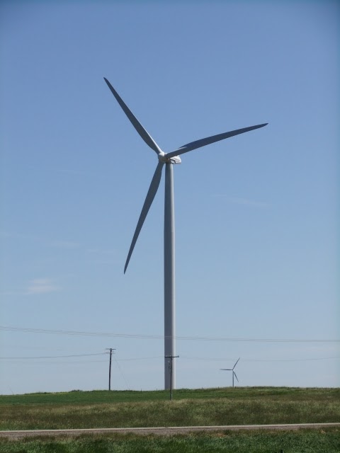
Shortly after passing Wapella today, I saw the first wind turbine farm of my trip. There were probably 20 to 25 turbines in the region. Later in the afternoon, I crossed the Saskatchewan-Manitoba, where there were two visitor centers (one for each province), and cookies & juice at both! Not sure if that was a Canada Day special or not.

Wind turbines!


Tonight  I am in middle-of-nowhere Griswold. Kind of a hick-town around here, but don't let anyone know I said that! :)

Also: Happy Canada Day everyone! If there are fireworks in my town, I might wake up and snap a few pictures.

Monday, 27 June 2011

Drumheller to Saskatoon

Distance travelled over last 5 days: 497 km (and another ~40 km by car)
Total distance: 2077 km

Prairie weather is an fascinating thing. As I made my through Calgary-Drumheller-Chinook under fair-weather conditions, I was also dodging rainstorms left and right (or east and west, if you prefer). It seems like the storms around here can develop in a flash, and they can be over you before you know it (more about that later).

Looking eastward while tenting at the outskirts of Drumheller, I witnessed some of the most dynamic skies I've seen along my trip. The night proved to be dry and warm for me, but as I headed eastward the following morning, the Delia cafe owner told me about the two inches of rain that hit their town in a span of 15 minutes. I'm pretty happy I didn't have to tent out in that!

Looking eastward from Drumheller towards Delia
The wind is a love/hate relationship. First the hate: Drumheller to Chinook, and Chinook to Kindersley were back-to-back days of moderate headwinds. On a windless day I might average close to 25 km/h on such terrain, but in the wind with my bulky and weighty load, I could only manage 18. "The invisible force" elevates the demand on the body, and requires extra power and energy to get from A to B. I was very pleased with my effort and determination, after arriving in Chinook, to have covered in excess of 150 km. It was a very long day of cycling through flat terrain and straight highways. As much as I wanted to hit the imperial century mark of 100 mi (160 km), which I would have attained by persisting until Cereal, I knew it would be better for me to tent and rest up when I reached Chinook. That evening, I met Denis and Sonja at their quiet residence in Chinook. They were very welcoming: I tented in their yard, and we shared a range of conversations both in the evening and the next morning. In their backyard, a whole range of birds take sanctuary, and start their morning singing at about 4 am. The only bird I could identify was the mourning dove, which was unmistakable thanks to Mom and Dad's bird clock which hangs in the kitchen.

Like I said earlier, storms can develop in no time at all on the prairies. Day number 21 from Chinook started out with fair weather. I crossed the line from Alberta into Saskatchewan, passing the border town of Alsask along the way. A little ways further, and thunderstorms started to appear on the horizon - both to the east and the west. The skies started to darken around me.


The calm before the storm

It started to spritz a few raindrops. Getting ready for an "adventure", I donned my rain jacket and shoe booties. The rain intensified, and the winds started to blow crosswise. Sooner than I could expect, the rain was pelting down sideways. It was about 3 pm, and I was enveloped in darkness! The wind forced me to lean my bike in order to hold my balance, and finally, when the gusts challenged my ability to stay on the shoulder, I decided I had to stop for my own safety. I couldn't be seen in the rain and darkness, and I couldn't even hold a straight line!

Thankfully, I had two helmet-mounted strobe lights. I flipped them on and swivelled my body around, signalling down the first pair of headlights coming my way - it was a truck. The driver stopped, and I ran up to the window; I didn't even have to explain myself: "Get your stuff in the back, I'm getting you out of here!" she said.

I stepped into the cab wearing a soaking wet jacket. The rain was so loud on the windshield that we could hardly hold a conversation much of the time. Shannon, as I found out, was on her way to Kindersley for an appointment. She lives in that tiny town of Alsask I had passed up just a little while earlier.

Roughly 40 km to the east, the rainstorm never really hit Kindersley. It was fairly sunny, and certainly quite warm. The two of us stopped at Timmies for drinks and conversation before she took off on her business. I regret not having the presence of mind to get some form of contact information so that we could have stayed in touch.

I found residence that night with a last-minute couchsurfing request to Teagan. We had a fun hour or so of conversation while preparing and enjoying a chocolate fondue before I took my rest. Fondue is quickly becoming the comfort food of choice for this trip - it started in Calgary.

After a rest day to regroup in Kindersley, I took off for Rosetown... or so I thought. With heavy tailwinds, I made it to Rosetown by about 10 am. After eating an entire roast chicken for lunch, I decided to go for broke and set my sights for Saskatoon - one day ahead of the plan. Even 200 km isn't too far when you're sustaining 35, even 40 km/h down the highway. All the way to Saskatoon, the weather was sunny and bright. The riding was easy; my only job was to keep the cranks going around.

207.2 km from Kindersley to Saskatoon
Needless to say, I surprised my host in Saskatoon, Brad, by showing up a day early. Armed with an incorrect phone number, I wasn't able to get a hold of him to let him know about my amazing pace for the day.

Today, I rested in Saskatoon to attend a local church, visit the downtown district, and listen in on the jazz festival. In the evening, Brad, his fiancee Christina and I cooked up some butter chicken and (of course) chocolate fondue for the all the guys staying at the shared home.

In other news, my chinstrap tan-line is coming in real nice.

Monday, 20 June 2011

Fairmont to Drumheller

Distance traveled over the last 7 days: 530 km
Total distance: 1580 km

The rockies were really amazing. Although vistas were hidden by overcast skies for most of my two-day journey through Vermilion pass, there were many animal sightings, including rams, mangy-looking mountain goats, and a bear cub.

The mountain pass is characterised by two summits separated by a long valley. At about 100 km in length, the whole pass can be negotiated in one day; however, I decided to camp at Mcleod Meadows on the advice of my previous host, Dave. I also wanted to play my chances to see if I'd get better weather on day two. At camp, rain hit, and I ended up pitching my tent in the downpour. It was poorly timed, because a little while later the rain let up, but I was still left with a wet tent.

There were a few other campers in the park on the night of the Canuck's game 7 match-up. I shared a fire with Jason and Naomi, which I used to dry out my soaked clothing. I also heated some rocks to warm my sleeping bag - it was going to be a cold night.

The next morning I found some very tame deer wandering the campgrounds for food - I couldn't scare them away. Thankfully their roaming about wasn't a nuisance. Around the noon-hour I crossed the continental divide (which delineates the Pacific ocean drainage basin), and after descending into Castle Junction, decided to push onward to Banff. Turns out I probably traded a quiet hostel at the junction for a noisier, more expensive one.

Like the rockies, Banff was also overcast, so instead of hanging around to do touristy things, I left the next day for Calgary. Both the weather and the view improved as I went on my way. I passed by a pair of other cyclists - Jason and Isabella - who had left from Whistler and were headed to Montreal. They were traveling much heavier than I, each with panniers and a trailer to boot. Alberta sure is flat in comparison to BC - there seems to be one exception, however: Calgary. I would spend the next three nights in the warm company of the Wiebes, who live on one of the hilltops in Calgary. They were wonderful hosts, and were receptive to my desire to extend my stay in order to connect with the rest of the saints in Calgary on Sunday.

Since leaving Calgary, I've had fair skies. In Beiseker, I met Verlin (three separate times, actually). A semi-retired school teacher and singer-songwriter, he's trying to launch sales of his first CD. I told him to get a myspace webpage and keep in touch. Verlin, post a comment with a link to your myspace page if you're reading.

A touring cyclist once passed along the advice that "the difference between an adventure and an ordeal is attitude." If I had remembered that after leaving Beiseker, it would have helped me manage my detour around impassable construction on hwy 9. My "home-brew" detour consisted of 10 km of farmers' roads of various textures: from gravel to muddy patches! After lugging my bike through several mud-slicks, my shoes, wheels, fenders and brakes were in need of a serious cleaning!

I didn't quite make it to Drumheller in one day, so I camped in Carbon. Verlin had spoken affectionately of the place in a passing comment that afternoon. It was great tenting weather, and camping in Carbon set me up for an easy ride into Drumheller the next day, with lots of time to go sightseeing.

Riding into Drumheller was stunning. The natural erosion of the mountains, and the desert-like foliage fit the Jurassic-mania that fills the city. While in Drumheller, I climbed up the 86' tall dinosaur outside the visitor center, and visited the Tyrell Museum, where I saw enough dinosaur replicas to make my eyes weep from exhaustion.

Tonight, I have pitched my tent a few kilometers north of the city, on a plot of grass kindly provided by a farmer. It's windy tonight!