Distance travelled over last 8 days: 732 km
Total distance: 8257 km
Halifax would be the last major stop on my way to St. John's, Newfoundland. I had important business to do while I was in town, like booking a flight home, getting a mechanical check on the bike, and purchasing camping supplies (such as stove fuel).
I left Halifax on Sunday afternoon, after an enjoyable morning with the saints in the city. My route took me along the eastern shore of Nova Scotia. This was a scenic and fairly quiet ride (traffic-wise), past many coves and sheltered lengths of coastline. The next evening, I ventured inland somewhat, in favour of a more direct route towards Cape Breton. It had been a pleasant and sunny day, but a strong wind had been crossing my path most of the day - at times I had a helping tailwind, which was nice. The wind didn't appear to be letting up by the evening, and it was bringing in some threatening cloud-cover. In the small community of Giants Lake, I met JD and Ann. I was looking for a place to pitch my tent, as usual, and they were both interested in helping me pick out the best spot on their large, undulating property. My suspicions about the weather were right: JD said the overnight forecast was for 15-25 mm of rainfall, and sustained high winds. After about 10 minutes of surveying the land with the weather in consideration, Ann suggested that I might sleep in their camper for the night! What an unexpected, and pleasant surprise! Of course, that was an offer I could not refuse.
Before I left on this journey, Dad had told me about how friendly the east coast was. Now I was humbly benefitting from it first-hand! I spent some time with JD and Ann around their kitchen table, talking about my travels and our families. Ann packed me up some fresh homegrown beans, carrots and plums - very tasty! Thinking back, I grin at the way Ann, in particular, sorely lamented when I insisted that nothing more could fit in my bags!
It turned out to be a very good thing I had the shelter of the camper for the night. The storm came on with a sudden start, catching JD with an onslaught of rain as we talked at the camper door. Our conversation suddenly terminated, he hurried for the house, and I shut the camper up for the night! The winds rolled in wild and strong. It may have been my imagination, but I think I could almost sense them rocking the camper in the night.
In the morning, I woke to find the storm had passed, and the weather was calm again. JD and Ann greeted me as we all made preparations to hit the road early in the morning. Thank you, JD and Ann, for a really enjoyable time and some great memories!
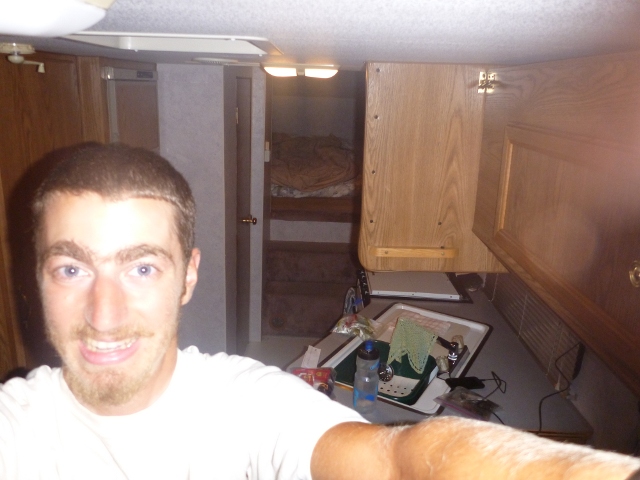 |
| Do I look excited to be sleeping in a camper? |
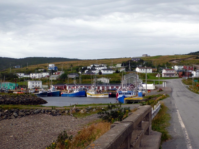
The strong coastal wind was still blowing as I traced a route along the coast of mainland Nova Scotia towards Cape Breton. There is only one crossing onto the island of Cape Breton, which forced me into a switchback situation: I cycled into a stiff wind for 20 kilometers, crossed the land bridge, and then cycled with the wind for a little while. Like the days before, the ride passed by many coves and small communities. The most spectacular of all was Pirate Cove. I spent my last night in Nova Scotia free-camping at Leo's place in Grande Anse.
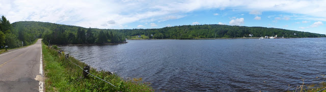 |
| Pirate Cove (panorama) |
 |
| A bridge and canal structure complete the north end of the land bridge to Cape Breton |
The next morning was on the cold side. It may have just been the shadows from the trees, or the fact that my sleeping pad had a leak and went flat overnight, but at any rate, the coffee Leo made helped warm me up and get me on my way. I had a ferry to catch, after all!
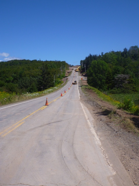
I cycled along highway 4, which follows the south side of the Bras d'Or Lake. This was not a simple ride - steep and hilly roads linked cove to cove. As I approached the largest of the climbs, near Irish Cove, I was greeted by a big highway construction project. Traffic was reduced to single-lane alternating, with a pace car at the front. The hill went on for a couple of kilometers, and I rested at the top to take some pictures of the lake.
 |
| This looks like a nice place to live |
 |
| Cameras don't do hills justice. This one in particular! |
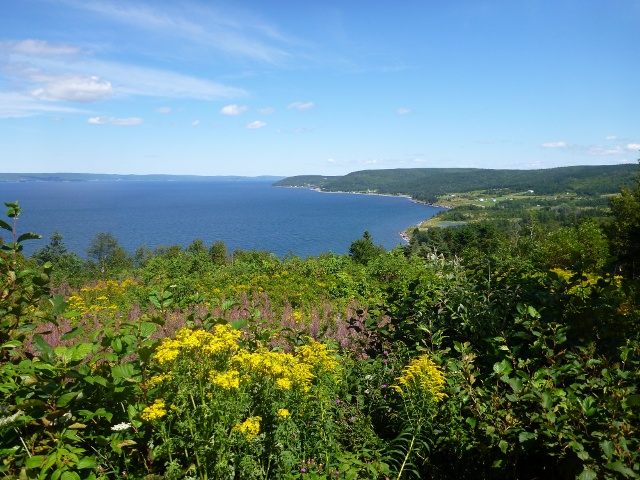 |
| A view of Bras d'Or Lake from the top of the hill |
In the Cape Breton area, the city limit signs are in English and Gaelic. Kind of neat, although I think it's more of a tourism ploy than anything practical.
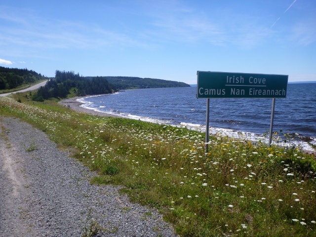 |
| Looking back: Irish Cove sign also in Gaelic |
I got to the ferry in North Sydney in good time - early enough to make a good dinner at a park, relax, and then find the showers in the ferry terminal. Boarding time for our ship, the Atlantic Vision, wasn't until 10:30 pm, so I also took time to plan my route on the free Newfoundland maps in the lobby.
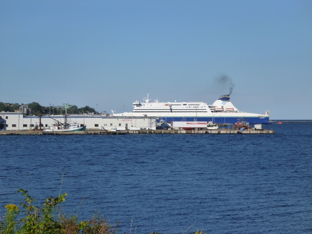 |
| The Atlantic Vision docked early in the day |
There were a good 10 or so cyclists catching the same overnight ferry to Argentia; None of them very social outside their own groups, however. Most chosen to pay for a cabin on board the ship. I, on the other hand, went for the more economical couch-crashing adventure. I started out the evening in the theatre, but quickly found that sleeping in the chairs was difficult and awkward at best. So, at about 1:30 in the morning, I went up a deck to the panoramic lounge and viewing area, where I found a couch to spread out on... much better! If only I had taken my sweater or sleeping bag to keep warm! It was a slightly uncomfortable and noisy night, so I didn't get a whole lot of sleep. On top of that, I forced myself to wake up at 5:45 am to watch the sunrise. The ferry was sailing directly into it, which was pretty cool.
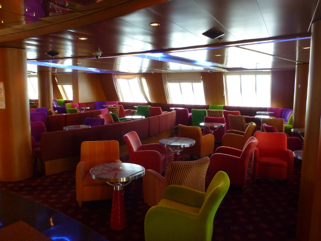 |
| The lounge area |
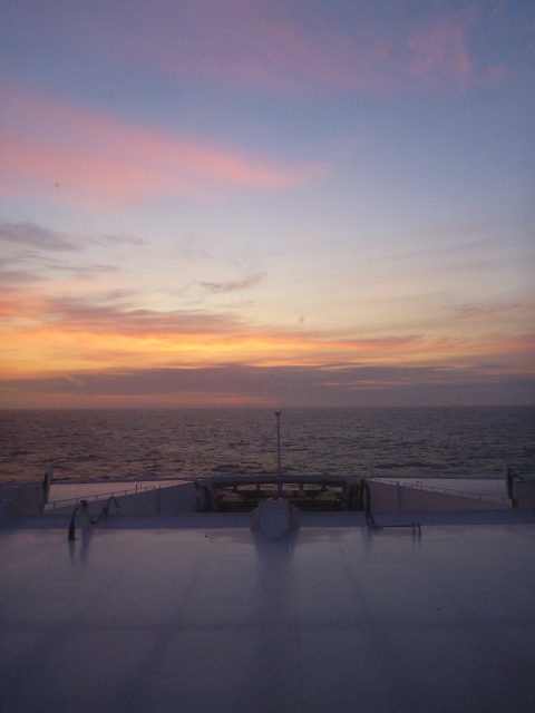 |
| Sunrise over the helm |
Later in the morning, I went for the breakfast buffet. It turns out it would be all the food I would need for the day. I spent several hours dining on scrambled eggs, bacon, sausage, roast beef and fruit platters. I also got a dose of news media - including coverage about hurricane Irene, which was projected to influence areas as far north as Newfoundland and Labrador. "This", I thought "could be a game changer."
In the afternoon, we started to sail past the coastline of Newfoundland. I haven't seen anything quite like it before. The landscape and vegetation are uniquely different to the rest of my journey in its entirety.
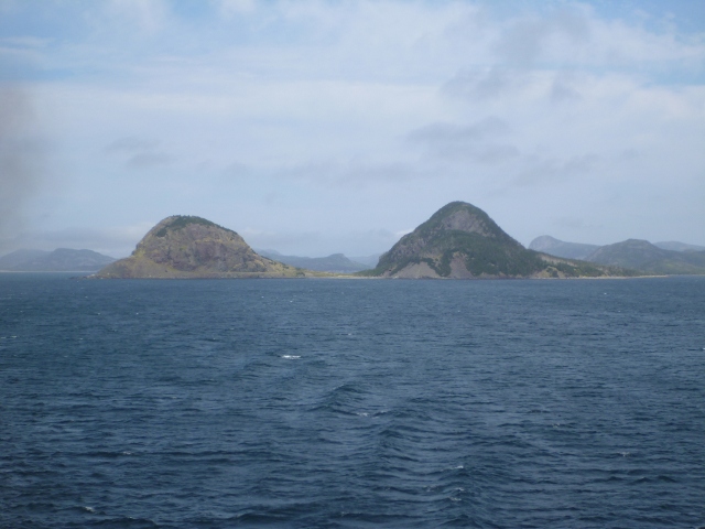 |
| No, it's not Ogopogo. It's Newfoundland! |
When I landed in Newfoundland at 3 pm, however, I suddenly found I was going to be in for one of the most challenging rides of the entire trip. Packed down with enough food for 5 days, as there wouldn't be a grocery store in sight, I set sights on highway 100 south, and into a strong 20 km/h wind. I hopped from cove to cove, taking on brutally steep slopes of 10% to 14%. I could only manage 35 km before sundown, having conquered 7 or 8 of the monster hills.
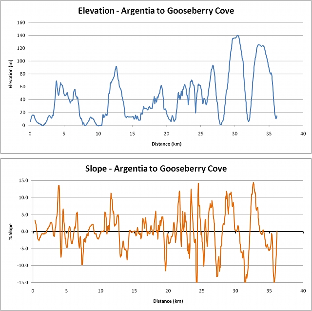 |
| Factor in the headwind and the weighty load, and I think this is the hardest 35 km I've ever done |
Difficult though it may have been, this was easily the most spectacular stretch of coastline of my entire trip, and the setting sun put a beautiful red glow and dramatic shadows onto the rocky cliffscape. I camped out for the night in Gooseberry Cove, on a stretch of beach next to the ocean.
 |
| A lone tree by the ocean |
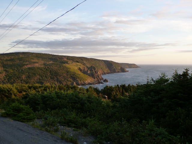 |
| The best vantage points are from atop the hills that separate the coves |
 |
| The sun sets for another night, and I'm exhausted! |
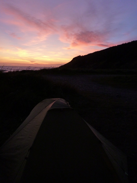 |
| Top notch camping spot |
The next day, I got the weather forecast from the locals - afternoon rain for today's ride, and high winds (75 km/h) the day after next, on account of hurricane Irene. Fortunately for me, I only had to pedal another 20 km into the wind and over the hills before I reached St. Bride's and changed course. After that slow stretch south, my pace picked up immediately, and after going north up the other side of the peninsula, I found that I had covered nearly 100 km by 2 pm. Regrettably, the late morning rain had caught me as forecasted, pelting into my face on the fast stretches, and generally working its way into my body.
 |
| Looking back towards Branch, NL, just before the rain started |
I got to Colinet chilled and wet, but I met Joe, who kindly welcomed me into his home. I was able to shower and dry up, put together some dinner, and rest for the evening in a spare bedroom! Thanks Joe, for your friendly hospitality. By this time, I had changed my cycling plans; With a flight to catch out of St. John's on September 1, I wanted to make sure I'd be there in time. Based on the ridiculous hills of the first peninsula, and the uncertain weather implications of hurricane Irene, I decided I couldn't afford to cycle along the second peninsula and through Trepassey on such a tight schedule. The weather or terrain could easily slow me down, or force me to take a rest day, and then I would miss my flight.
So, from Colinet, I took the shortcut into St. John's. This would be my last day of cycle touring across Canada! Happily, it was sunny and pleasant outside. I reach the city early in the day, and it was an ideal time to do as much sightseeing as possible.
First, I cycled through the downtown area to make my way over to the Battery, a community that sits on the cliffs that give way to St. John's harbour. After a bit of exploring in the neighbourhood, I took a trail eastward, which passes by the narrows to the harbour and heads for the Atlantic ocean.
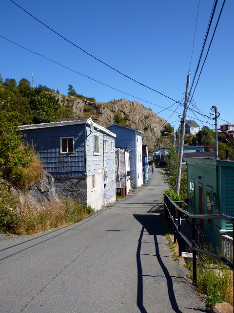 |
| A street in the Battery |
 |
| The Narrows to St. John's harbour |
 |
| The Battery |
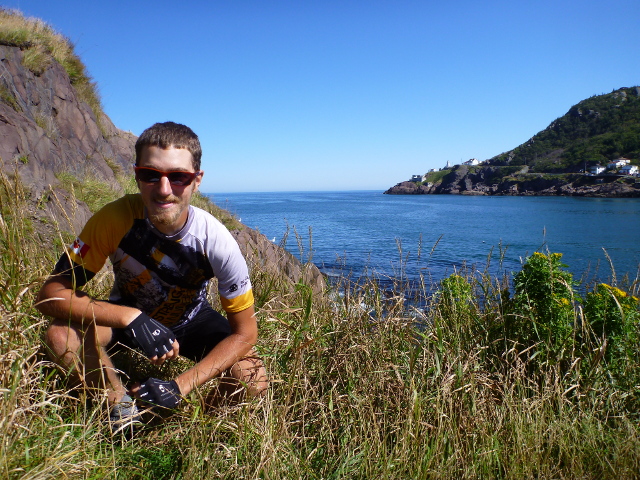 |
| Taking a seat in front of the narrows |
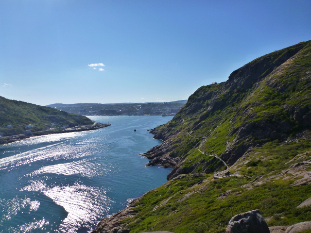 |
| Looking back towards the harbour and the trail along the rocks |
I also made my way up to the very summit of the cliff - to Signal Hill. This was an important strategic location for communication and defense for centuries.
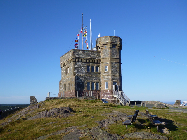 |
| Cabot Tower atop Signal Hill |
 |
| Which way to...? |
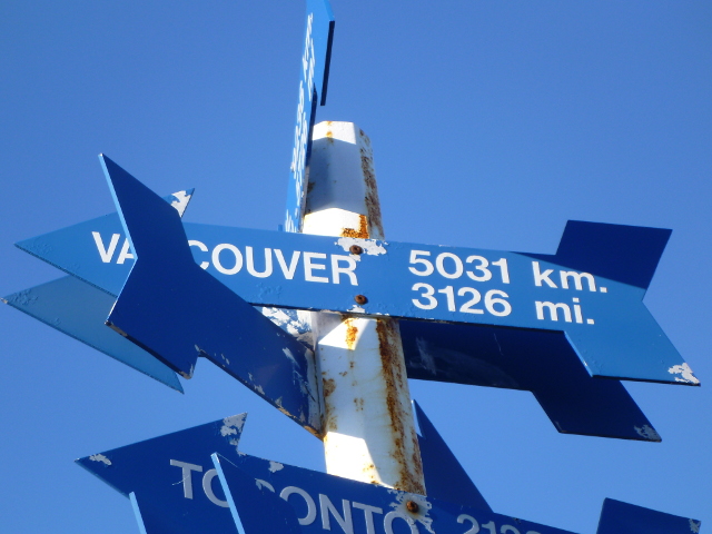 |
| Vancouver, only 8257 km away... oh wait - I took the long way! |


